A Note on Technology 24 March 2009
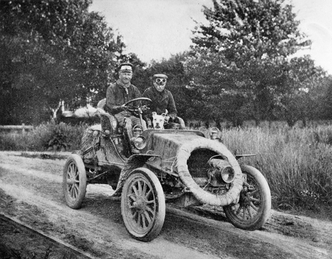
I’ve been thinking a great deal about Horatio Jackson Nelson, who drove a two-cylinder 20 horsepower Winton touring sedan from San Francisco to New York from in the summer of 1903. His two-month odyssey (May 23rd to July 26th) is generally regarded as the first cross-country road trip. Horatio’s Drive was an impressive feat, but he spent much of his time waiting around for his driving companion, a bike racer and mechanic named Sewall Crocker, to fix the Winton. (His other driving companion, a bull terrier named Bud, just took up space.) Horatio also spent much of his time driving, lost, through, trackless countryside.
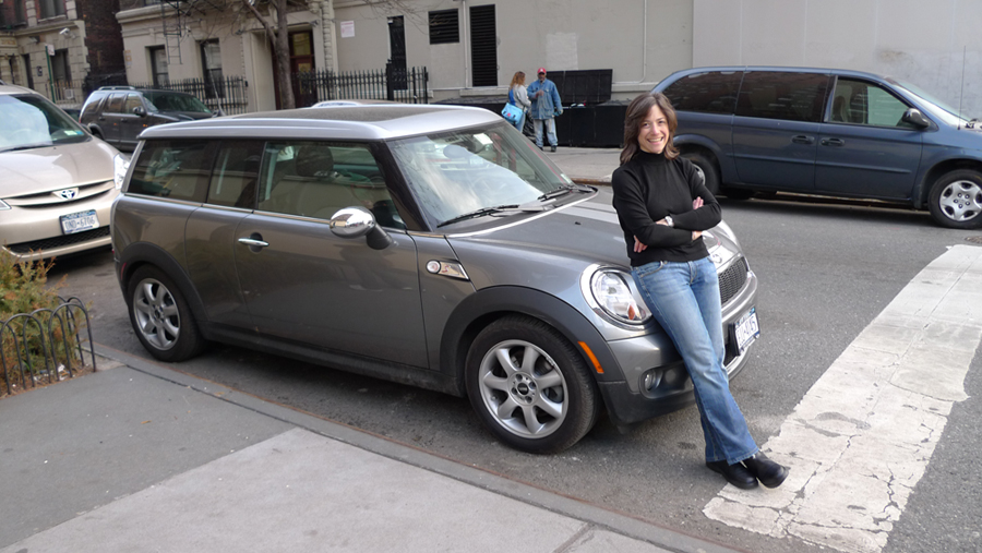
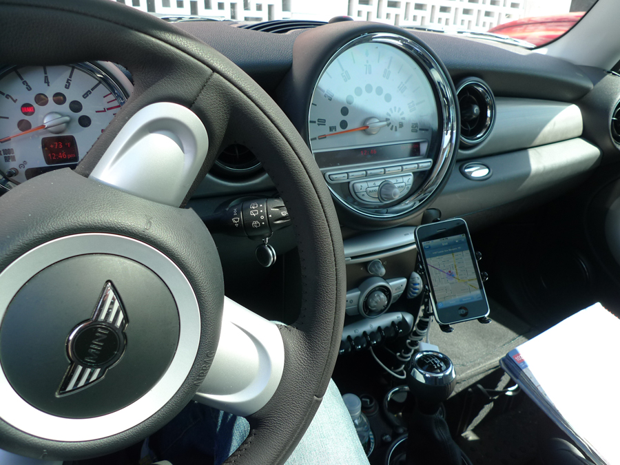
106 years later my road trip is a lot easier. For starters, I’m driving a four-cylinder 172 horsepower Mini Cooper S Clubman. My gas tank is only marginally bigger than Horatio’s, holding 13 gallons to his 12, but my gas mileage his considerably better. I get over 400 miles out of a tank; Horatio got less than 200. Of course, my mileage would be much better if I drove more slowly, but then my top speed is 139 m.p.h. whereas Horatio couldn’t get much higher than 30.
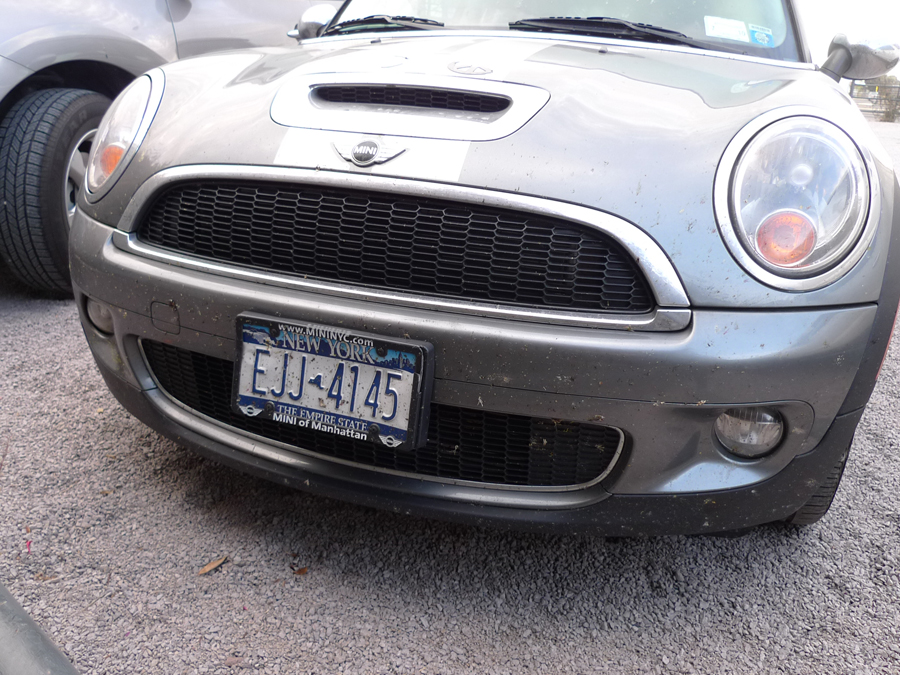
Unlike Horatio’s, my car is equipped with a windshield that has proven quite handy for keeping kamikaze bugs at a safe distance as they hurl towards me, sadly ending their days splattered across the glass, and the radiator grille, and the rearview mirrors. This was more of a problem in the swamplands of the South though somewhere in Arizona a beautiful Monarch met an unfortunate end on my car’s front end.
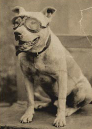
The only bad thing about the windshield is that it removes my only legitimate reason for wearing driving goggles and Bud looked quite fetching in his.
While I don’t have my own mechanic, I have a handy directory of every Mini dealer in the country, plus roadside assistance should I breakdown. And, of course, I have a phone for calling roadside assistance, or the police in case of emergency, or to make hotel reservations, or to tell a friend I’m going to be late arriving because I detoured for fried catfish.
And because that phone is GPS enabled with internet access, I have detailed road maps and driving directions and addresses and miscellaneous useful information for nearly every possible destination at my fingertips. What time is the last tour of the day at Shadows on the Teche in New Iberia, Louisiana? (It’s 4:30.) What’s the name of the famous BBQ joint in Luling, Texas? (It’s City Market.) What’s the meaning of the Texas highway designation F.M.? (It’s farm to market.) How late can we drive through the Saguaro National Park in Tucson, Arizona? (Until sunset.) It’s all at my fingertips.
The fact that I have road maps indicates yet another advantage I have over Horatio. Outside of cities and towns, he had to rely on railway right-of-ways, and there was still plenty of country without even the railroad. By contrast, I’ve got roads, and lots of them, perhaps too many.
In the past week, I’ve driven over 4,000 miles on local roads, interstates, scenic parkways, secondary highways, by-passes, and through-routes. It seems as if there is a road to suit every purpose and mood, from pleasure driving at 30 m.p.h. to flat out cruising at 90+ m.p.h. What with all this infrastructure and equipment my road trip is much more a gentle adventure than Horatio’s wild ride.
Of course, there is such a thing as too much information. Looking at my road atlas after I crossed into Arkansas last week, I determined that I could get across the northern part of the state on a single road, Highway 412. I had to take Highway 412 about 300 miles, turn onto Highway 62 and that was it. This seemed easy: the line of the road was meandering but it went from my point A (the state line) very nearly to my point B (Eureka Springs) without much confusion.
_________________________
Just to be on the safe side, I punched points A and B into the iPhone’s mapping app and it produced a set of ridiculously complicated directions. There were over a dozen different directions just to follow the same line that I drew with my finger in the atlas. The difference was in the specificity since the app tells you every time a road changes names. State highways that pass through small towns change names a lot. To the thru-route driver these name changes are of little consequence. To the mapping software these name changes are critical data points, mile markers on information superhighway.
I turned off the screen and drove on, not exactly off the grid but at least off the GPS.

Leave a Reply
You must be logged in to post a comment.